
Introduction to Levelling
What is “Levelling?”
Levelling is the process by which differences in height between two or more points can be determined.
Leveling is a branch of surveying, the object of which is to find or establish the elevation of a given point with respect to the given or assumed Datum (reference point).
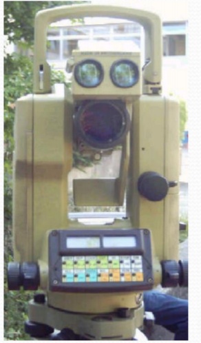
Common leveling instruments include the spirit level, the dumpy level, the digital level, and the laser level.

Some Basic Definitions:
Level surface (e.g. the geoid)
A water surface with no motion
Gravity gradient is the normal to the level surface
The Instrument’s Bubble is in the normal (!)
Horizontal surface
At the instruments axis, the horizontal surface is tangent to the level surface
Over short distances (<100 m) the horizontal surface and the level surface will coincide
For long levelling lines the effects of the gravity field must be considered
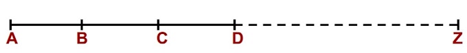
Basic Principle of Levelling
Measures height differences between points
-Along a line
-Several points from one occupation

Back sight (BS)
The first reading from a new instrument stand point (i.e. take the height to the instrument)
Fore sight (FS)
The last reading from the current instrument station (i.e. give the height to a benchmark)
Intermediate sight (IS)
Any sighting that is not a back sight or fore sight
Read the [m], [dm] & [cm]
Estimate the [mm]

Check yourself for frequent used numbers(readings).
Basic Rules for Leveling:
Always start and finish a leveling run on a Benchmark (BM) and close the loops
Keep fore sight and back sight distances as equal as possible
Keep lines of sight short (normally < 50m)
Never read below 0.5m on a staff (refraction)
Use stable, well defined change points
Beware of shadowing effects and crossing waters


0 Comments