
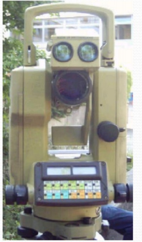
Compass surveying
The principle of surveying is traversing. which involves a series of lines which are connected
When triangulation is not possible, traversing method is used. In traversing, when compass is used for making angular measurements, it is known as compass traversing or compass surveying.
When triangulation is not possible, traversing method is used. In traversing, when compass is used for making angular measurements, it is known as compass traversing or compass surveying.
 PURPOSE AND PRINCIPLES OF COMPASS SURVEYING:
Compass surveying is suitable in the following situations:
1. When the survey work is to be completed quickly.
2. When the area is hilly and chaining is difficult.
3. When the area to be surveyed is relatively large.
4. When the details are too many.
5. When the area is can not be divided into network of triangles.
6. When the area to be surveyed is long and narrow e.g. road, stream
etc.
7. When the survey is to be done through dense forest.
Principle of Compass Surveying:
In compass traversing the directions of survey lines are fixed by angular
measurements and not by forming a network of triangles. A compass survey
is one in which the traverse work consists of series of lines the lengths and
directions of which are measured with a chain or a tape, and with an angular
instrument respectively.
A traverse may be classified as:
a) Closed traverse
b) Open traverse
A) Closed traverse:
A closed traverse is a traverse in which the sides
of a traverse form a closed polygon.
B) Open traverse:
An open traverse is a traverse in which the sides of traverse do not form a closed polygon.
Direction is measured by:
compass.
Ground distance is measured by:
metre tape;
surveyor’s “chain”;
rangefinder.
Slope distance to horizontal distance:
Slope distance on the ground must be “flattened” to horizontal distance.
Measure slope angle with:
- clinometer;
- slope needle on compass;
- handmade clinometer.
Calculate horizontal distance:

Use the equation:
Horizontal distance = slope distance x cosine of slope
Planning the traverse route:
1. Select a starting point.
2. Plan the route with a sketch map.
3. Choose from four traverse patterns:
linear traverse;
radial traverse;
grid traverse;
closed traverse.
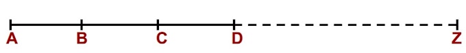
Linear traverse
Follows a line such as a road or stream

Radial traverse
Several linear traverses starting at one point
Useful when trails radiate from a village centre

Grid traverse
Parallel linear traverses forming a grid
Allows systematic mapping of an area
Often used for resource inventories

Closed traverse
Follows the perimeter of an area or territory
Allows for the calculation of area


0 Comments